Shane's Flat Earth Dome Model
Important Note
I know that Globers misrepresent perspective and misuse this model to attempt to discredit flat Earth with a bunch of unneccessary bendy light lines:
This Flat Earth Dome Model can make correct predictions for many observations, because:the globe model was derived from the same celestial observations in the first place.
This Flat Earth Dome Model is entirely based on observed cyclical celestial patterns and orbits. IT IN NO WAY uses Newton's Laws of Gravitation and Motion, the bending or warping of space time, or any heliocentric specific attribute for calculations. It uses in real world measured 3D Orbits, Constellations, Inclinations, Axial Tilts, Distances and Velocities, and the correct Sizes and Masses of Sun, Moon and Globe Earth to calculate all Observables.
The Model
- Intro
- Eclipses
- Equinox
- DayNight
- Poles
- Stars
- Reset
- <<
- Play
- >>
- 0
Purpose of the Model
With this excellent Model I intend to show that the geometric and physical aspects of this combination make perfect sense in reality. The personal celestial sphere moves perfectly over and around the observer 1 degree as they process 69.07 miles across the horizontal axis. The relationship becomes much more apparaent and logical consistent. assolutely apparent and logical. This is just one more example of the way they have hijacked the way perspective actually works and negariously repurposed it to suit their model. There is a limit to your vision, and light will attenuate over distance. Things recede into the horizon with distance, and they have long since convinced you this was because of earth's physical curve.
We have since been able to mathamtically derive the radius of the limit of our spherical vision in simiilar experiments, and we have supplamented these advances with a replacement mechanism and formula. Instead of earth physically curving at 8 inches per mile squared, we are claiming the optical limit of our spherical vision is exactly the same as the radius of the earth. It would only mean that they knew this was an optical efect, and could easily convince the world the inverse was true instead. And they had the math to convicne the un prepared. In anycase, we now have the math to reclaim what they have stolen. If we can in fact, NOT see forever, and we assume there is a finite limit to our vision, then we only need to further assume that the limit of that vision is exactly equal to the limit of the physical curvature that was said to be causing the exact same effect.
Furthermore, the only way to model observable reality is to match observable reality, and it is time heliocentrists stop claiming things that plainly kinematically equivalent between the two models, and always has been, since before the insertion of the this globe lie in 1900.
https://publish.obsidian.md/shanesql/Library/Geocentrism
https://publish.obsidian.md/shanesql/Library/Kinematics+vs+Dynamics
The basic idea behind the model is: What if we project 3D space with Sun, Moon, Planets and Stars onto the Flat Earth simply 'as is'? Does it not match observations for both models? Does this not also conform to the consensus of the scientic body? It absolutely does.
We simply take all observations for all observers for 3 years from the already mapped data (globe),and force that data onto a plane. No data is changed, no relationship between any other longitude or latitude is altered, as would be required in any map transformation. Distannces remain scaled and no data is lost.
In this case, it is also equivalent to show any of the available projections of the primary coordinates. We chose this projection to instruct those who lack patience.
The Flat Earth and the Globe are both equal projections of the same coordinate system.
https://publish.obsidian.md/shanesql/Library/Maps+and+the+Coordinate+Systems+they+are+Projected+From
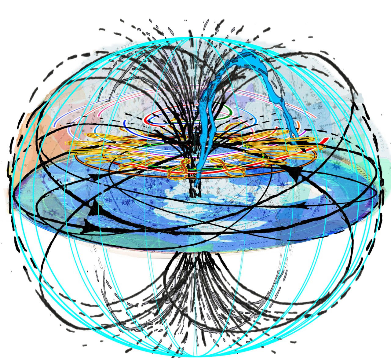
Note that although the Dome itself may be 3D, it only represents a 2D surface. The Sun, Moon and Stars on the Dome never go physically below the horizon. This has always been a simple product of the limit of our vision and the angular resolution limit of our optical range. Again our math supports this. This also demonstrates why the sun never truly changes angular size: it is always the same distance from you. If you are limited by 3,959 miles in the celestial heavens in every direction, that would naturally create a spherical limit aound you. This could easily be called the celestial sphere. Infact, it is exactly the celestial sphere of the globe, if you consider thaf halt the visible sky in each would, by the equivalence principle
But if you assume vision works exactly as gauss described, than an amount of optical angular excess observed prior to any measurement can determine the radius of the spherical limit of vision as 'spherical excess'.
Every single stellar observation is absolutely explainable and predictable in a geocentric model. All the intelligent people freely admit this. If you look into it, you will conclude the same. The dishonest way this model has previously claimed heliocentric exclusivity is hereby revoked.
If you think you have grounds to justify that, you will have to show me the in the public source code which function utilizes a call to gravity or invokes the mass of a nearby object for me to consider a change. Until then, this is absolutely fair.
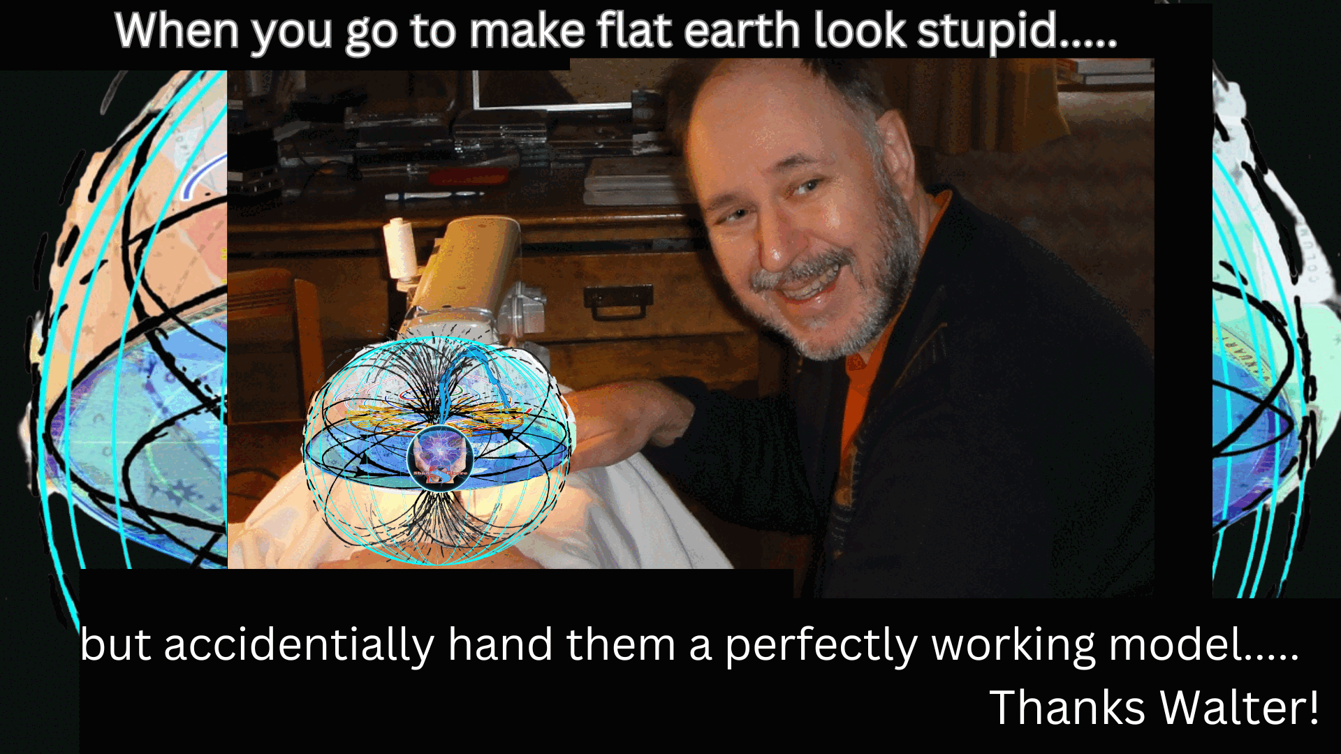
Walter himself used this section of the former model to publicly display the constraints of stupidity his position laid on him. He BOLDLY claimed eclipses were exclusive to the heliocentric model, and I can assure you that is absolutely false as well. See the database below for more about that. But again, there is an established, proven, well known equivalence between all observations of the sky. See the geocentrism page at the end for more. The only thing exclusive to the globe about these predictions is the map it can be projected on. Since there is only 1 set of coordinates that can be translated into any of 200 projections, and the data from any map can absolutely be translted to and from a globe with ease, it can only be concluded that the globe is one of those projections.
The reason geodesic arc lengths match up with curvature is because the coordinate system is based entirey on the celestial. If you have a celestial sphere mapped onto a flat plane you will undoubtedly introduce some sphericity.
Now, the final objections here were about the eclipse time predictions. Once again, we have covered the history of longitude and how that was derived which included a full accounting of the various methods of deriviing time before longitude. To claim that only the globe can predict the time is a complete display of ignorance. Walter directly assumes only because the earth is spinnning can they predict the time. They fail to understand we live in the same world, and have to explain the same observations.... Of course the sky rotates around the sky above us. It is our personal complete time piece, if you know how to read it.
We can predict eclipses to any gps coordinate on any 201 existing map projections that are based on the geodesic gps system. (any other maps are just artist renderings anyway) From any of these maps, one can predict the path of the eclipse. There is nothing exclusive to the globe here either.
Thanks walter!
https://publish.obsidian.md/shanesql/Library/Eclipses
The Heliocentric Model
To avoid some potential confusion, let me explain our position. There has been a great hijacking of perspective. It was determined that our vision is not euclidian, and that the distance scale based on the optics of our vision was only linear between a certain threshold.
They used this observation against us in the worst way. By allowing us to correct for the portion of the vision that was not linear, they forced us to conclude it was linear all the time. This is what was required for a steady in lightspeed to scale infinte distances and create the fantasical mathamatical abstractions known as galaxies in the
Many misunderstandings have resulted from a fair few
https://publish.obsidian.md/shanesql/Library/Optics+Angular+Resolution+or+Earth+Curve
https://publish.obsidian.md/shanesql/Library/69+Miles+Per+Degree%2C+you+say
https://publish.obsidian.md/shanesql/Library/Polaris+-+Stars%2C+and+Celestial+Sky
https://publish.obsidian.md/shanesql/Library/The+Celestial+Sphere
The Heliocentric model consists roughly of three sets of properties: geometric and physical properties and cycles. All of these principles are mirrored in the geocentric model. In fact, the heliocentric model was derived from a mathamatical translation from the geocentric one. Look it up. Sorry Walter!
Geometric properties are for example: sizes, distances, inclinations of orbits and the constellations of sun. The geometry of the observations also depends on the location and orientation of the observer. Like everyone prior to 1712 knew perfectly well, celestial observations are latitude dependent. Each 69.07 miles per degree you process laterally over this plane forces your celestial sphere up 1 degree if you are progressing towards the celestial object, and down 1 degree if you are progressing away from the celestial object. This can be applied to any static star and in any direction. The axis will only appear to shift when the move is along the north/south axis however, for the very obvious reason.
Physical properties are for example the heat distribution on earth from the sun that causes the seasons, solar winds that cause auroras, the heat emission of the earth into space that is responsible for the mean temperature on earth, terrestrial and astronomical refraction due to a density gradient of the atmosphere that influences how much of obejcts are hidden behind the curvature of the earth and how much celestial objects and constellations are squeezed at the horizon and the variations in the gravitational acceleration and coriolis forces due to the ellipsoidal shape and rotation of the earth.
Cycles can be derived from the geometric properties of the Heliocentric model by applying the laws of physics, which results in the Keplerian parameters, or calculated to some extend from careful observations. So the dates of cyclic events can be predicted either from properties of the Heliocentric model, or from observations of previsous cyclic events, for both flat earth and globe.
Properties of the Flat Earth Dome Model
Light-Bending: There is absolutely no silly light bending required for this model to perfectly emulate reality. A severe misunderstanding of light not withstanding, let us just assume that we again have taken all the true observations tied to the celestial coordinates as available, and projected that data onto on a completely valid equal projection, with a single change. We imposed a limit on the visual range of each observer instead of assuming that our vision extends indefinetly. We derived the radius of that limit through the other limits of optics already familiar to geocentrists of the discord persuasion.
https://publish.obsidian.md/shanesql/Library/Optics+Angular+Resolution+or+Earth+Curve
This model no longer assumes a physical sun or moon that require a collective convergence of every observer on earth, it only matches observations as recorded all across the plane. Your model awknoledges this and moved all the celestial bodies a near infinite distance away. The only thing that does is create a triangle so large you can mathamtically abstract your way into thinking the inverse of everything you experience. The truth is, every observer has a limit on their visual space, and this limit is geometrically required to be spherical. Because no one ever observes anything but an 'apparnent location' in their personal celestial spheres, there is no need to explain a tiny ball of heat mysteriously powering itself along at 3100 miles above the plane. This is not reality.
We feel we only have to model the exact position of each observer all over the earth, not to provide an explanation for what you think should be required.
This model is excellent to demonstrate the apparent size and positions of Sun, Moon and Star constellations. It also depicts the tracks, Star trails and Day-Night terminator as observed in reality for
each time and location on earth. Simply by observing reality and plotting that data on a planar map we demonstrate that the Sun, Moon and Stars can move beyond the limit of your vision, and become unresolvable to your eye at a certain distance.
We show how this can be confused with an assertion that they ACTUALLY go down below the horizon, when in reality they are only apparently dipping below the horizon when they pass out of limit of your vision. It is elegantly simple and easy to understand when you remove the bullshit.
Sun/Moon tracks: During 24 hours the sky with the fixed Stars rotates about 1 degree more than 360 degrees. So in 365.25 days the star constellations at the same time are at the same place in the sky again. You can see this in the model by advancing DayOfYear step by step (place the cursor into the field and hit arrow Up or Down). The Dome grid will advance each day by about 1 degree.
If you advance the time by 24 hours steps, the Sun moves up and down between the Solstice lines during one year, causing the seasons. The Sun also moves left and right a bit so it traces a figure 8. This is caused by the tilt of the Sun's Ecliptic plane at 23.44 degrees above the plane. You can see the tracks of Sun and Moon against the fixed star background (Dome Grid) by checking the options Sun track and Moon track. A desciption of the tracks is presented if you click the Eclipses button. These tracks correspond to what is observed in reality. The tracks are derived from the solar and lunar cycle and are absolutely not exclusive to either model.
It would be extremely dishonest to claim anything else. Sorry Walter.
https://publish.obsidian.md/shanesql/Library/69+Miles+Per+Degree%2C+you+say
https://publish.obsidian.md/shanesql/Library/Eclipses
Retrograde Motion of Moon's track: The Sun track stays fixed on the Dome Grid. But the Moon track slowly rotates retrograde against the Dome Grid and rotates one full rotation in 6798 days. This is due to the ocillation and intersection of the Moon's Orbit caused by the distant Sun. Currently the Moon Ecliptic is such that the track of the Moon extends the track of the Sun North/South about 5 degrees. In about 3400 days from now the track of the Moon lies inside the track of the Sun about 5 degrees. This observation is simply translated to the planar model.
Eclipses: The intersection points of Sun and Moon track are called Knots. There are 2 such Knots marked by a green dot. If Sun and Moon are exactly on opposite Knots, a Lunar Eclipse happens. If Sun and Moon are exactly on the same Knot, a Solar Eclipse happens (play Demo Eclipses from Step 6 on).
This Flat Earth Model can predict Solar and Lunar Eclipses. It can also absolutely predict the optical effect confused with the moons shadow on earth at solar eclipses or the optical effect confused with the earth's shadow on the moon during Lunar Eclipses. It does this by using a ratio provided as part of the cycle that is based on an observation of the radius of a shadow made by Phillippe de La Hire in 1700s. It was made during a lumar eclipse, but the ratio is applied to all future eclipses of an appropiate series. This ratio is then applied to the predicted track to dynamicly widen or shorten the track to accomodate the penumbral and umbral radial intersection as a visibile sphere on the plane. We then apply this integer as a scaler to correctly approximate the size of the optical effects confused with shadows. The map on which the eclipse can be projected are all still using the same globular coordinate system unfortunately. Now it can be shown that heliocentricity cannot predict eclipses at all, they can only interpret the cycle data the same way the ancients did, and apply more refined mathamatics.
Moon Phases and Orientation: The model shows the Moon Phases and the Orientation of the Moon with respect to the horizon at the location of the Observer. The apparent rotation of the Moon during the day is due to the fact, that the cameras up vector stays always perpendicular to the surface of the earth while following the path of the Moon. This perfectly emulates reality.
Equinox: This Model produces the correct apparent Sun positions at Equinox, so that the Sun raises at 6:00 AM due East and sets at 18:00 PM due West for every observer everywhere on earth.
Poles: This Model produces 24 hours day and night on the Northpole and Antarctica.
Heliocentric Model:Simple observations mathamatically translated to this planar projection perfectly emulate the tracks of Sun, Moon and Stars (Star trails), as they appear to each observer inside their personal celestial sphere. As with all other celestial observations, the Equinox, the Solstice Knots and the Day-Night terminator can be deirived from basic observation and data applied to the planar projection. No need for baseless assumption. On the Heliocentric Model utterly fails here. Newton's law can be reduced to a form without mass at all, and still manages to describe the same periodicity and thus the same relationship. No need for an exclusivity claim here at all, is there Walter? Someone clearly DID NOT understand the phrase "Kinematically equivalent"... sheesh.
Shapes on the Dome: The shape of Sun, Moon and star constellations appear on the personal celestial sphere exactly as they do in reality, and exactly as they did on when projected onto the globe. Again, because we invoke the same radius to describe the spherical limit of our celestial view, the very same observations become easily explainable with all the normal conventions, without a need to invent branches of physics and invert reality around it or anything.
All features of this Model are derived from observations of the sky only. And observations of the sky have always been kinematically equivaleent, or in other words, equally applicable to geocentric and heliocentric. This was rather the point of the invention of special and general realtivity (non sense) .
Problems with the Shane's Flat Earth Model
Distances: The biggest problem are people who misunderstand distances on map projections. On the AE map, distances exactly north-south are correct. All other distances are also proportionately correct. The way we are able to translate data between projections is tied to the coordinates we use. The longitude and latitude we use to project into any of the 200 map projections available, will ensure the distances between those points remains accounted for at scale. Please learn how map scaling works if this seems inadequate to you. Only an absolute moron would expect the visual distance to be equal in an equal area or equal distance cartographic transformation right Walter?
Personal Celestial Sphere: Sun and Moon trace specific paths on the celestial sphere. The paths of the celestial bodies are mapped from observations directly to the planar projection. They also follow the cyclical cycle of the heavens, and have no need of gravity, newton, or the very lackluster performance of gravitational predictions on systems of 2 bodies or more. The fact that poor walter actually wrote that gravity produced this was jaw dropping. I assume it was because he knew he would never have to answer any challenges? Show me the math that uses the gravitation of all the forces walter listed here and i will remove this section immediately.
Moon Phases and Field Rotation: The Moon phases and its apparent orientation for any observer on any place on earth, as shown in shane's FE model, perfectly model what every observer on earth sees, and where they see it. The 15 year solar cycle and the 18 (10/11) month lunar cycle have been known for so long, people forgot and were decieved about their paths. Only in moderntiy do the vast majority of people wander about under their own personal clock without the ability to read it. How sad.
The Day/Night terminatorThe shape that matches reality is a bit peculiar and it changes over the course of a year. The shape not only depends on the location of the sun, but its height and speed as well. Again, we know the sun circles the plane at a 23.4 tilt, and this perfectly explains the terminator line. There is absolutely no reason to invoke bendy light to explain any of these observations. It simply matches what we see. It models reality.
Missing the third Dimension: We need to correct the inherent misunderstanding in the assumption of physicality to any 'dome'. What we have modeled here is a personal celestial sphere. It used a radius It just so happens Shane has been arguing this concept and this radius since the say he showed Walter Bislan's model as evidence, despite the jeers of the uneducated masses. As it turns out, the personal celestial sphere is a visual limit imposed on your spherical view of the heaven. It most simply describes the particular slice of heaven you are able to see, and it moves that amount with you whereever you go. This is such an elegant, beautiful explanation to what had been perplexing flat earth for years... how the stars worked. The personal celestial sphere, once properly understood, is a perfect explanation for everything we see in the sky. It explains the curved nature of the arcs of summer and winter, and the behavior of the sun and the moon, as well as the apparent non movement of the static stars in relation to each other. Every single stellar observation is explained as well if not better than any explanation in the heliocentric model. Any person who incorrectly assumes visual distance scaling requires things to be visually identical in size demonstrates a massive misunderstanding of proper distance scaling inherent in all map projections, but in the AE map particularly. Its like everyone forgot the AE map is equal to the Globe map which is equal to the other 199 map projections. The projection does not matter people. They are all the same. They all represent the same distance. We can make predictions based on cycles as well as the next guy, so we wont need help there. As we keep saying, every observation in the sky is equal between geocentric and heliocentric viewpoints. People must be INTENTIOINALLY misunderstanding this by now.
Light-Bending: Is absolutely not required in any way shape or form. Observable reality matches the model in every way, i cannot imagine a better fit. To try to invent a need for bendy light now would only publicly highlight the inepitude of a lower tier glober, and their inability to learn and adapt on the fly, a vital skill in these times.
Our model perfectly models every observers azimuth and elvation of every celestial object in apparent positions. This is all we ever see. We feel no need to explain what has never been observed. The visualization of the south pole in action is actually what provoked Shane himself into the ultimate understanding of the celestial wheels, so thank you Walter again!
Light bending over Night-Shadow: To match the 24 hours Daylight on Antarctica from time and date.com, the light forms a shape congruent to a coffee cup caustic effect.
Shadows of Eclipses: Although the Model could predict the date of Eclipses, it was argued it can do nothing else. Please check into the links provided to see how absurd those claims are:
https://publish.obsidian.md/shanesql/Library/Eclipses
Conclusion
Some observations like the positions of Sun, Moon and Star Constellations as well as Sun/Moon-rise/set can be explained by a Flat Earth Model. If we allow ourselves to adhere to the mathematical principle of equivalence? What a concession....
Im going to leave this last comment up, because the ignorance is so astounding I want to warn people never to be as ignorant. 1) The AE Map is 100% 1:1 Distance equivalent if you understand how to use the scale provided with the ruler representing longitude accordingly. 2) You NEED TO LEARN ABOUT MAPS . Hopefully the covariant scaling and lossless unlimited translations between the projections will teach you one valuable lesson after all this hard work.
Equinox, Solstice, Azimuth, Elevation
The Model implements a perfect circular Orbit of the Earth around the Sun and a perfect circular Orbit of the Moon around the Globe Earth. This is because the Planar Earth has no moronic need of elipicity because they didnt back themselves into a logical corner by making shit up.
The Model chooses to match:
- Spring Equinox at 20. March 2017 12:00 UT
- Solar Eclipse at 21. August 2017 18:00 UT
Azimuth and Elevation of Sun and Moon are also slightly inaccurate (to the assumed heliocentric requirement) due to the use of circular orbits instead of elliptical orbits. This affects also the Moon Phases.
Computing Day-Night Terminator
The Day-Night terminator is derived from time and date to match reality as follows:
- A circle perpendicular to the axis Earth-Sun in the Sun coordinate system is computed depending on the Sun's position at a certain date and time relative to the intersection knot of the equatorial plane of the earth and the ecliptic plane of the Sun. Completely possible on both models.
- This circle is then transformed to the Globe Earth coordinate system. There is no way around using this coordinate system.
- Each point of the circle is then transformed to the corresponding Flat Earth coordinate system, which produces the shadows as shown in this Model. This is just a simple transform.
- At Equinox the transformation to the Flat Earth coordinate shows the light at all the proper angles since This matches observable reality. Points of the terminator line translated evenly and had no issues.
The special shape of the Night-Shadow produced by the mapping of the Globe Night-Shadow onto the Flat Earth results automatically.